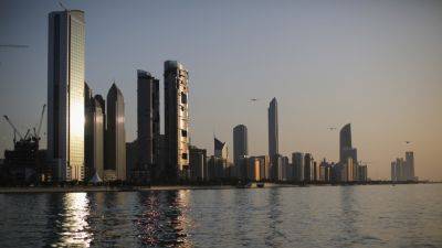
NASA releases satellite photos of Dubai and Abu Dhabi before and after record flooding
NASA released photos of parts of Dubai and Abu Dhabi before and after the United Arab Emirates was hit by record rainfall last week that caused dangerous floods and paralyzed much of the country.
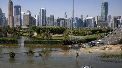
The images, taken by the NASA Earth Observatory on Friday using Landsat data from the U.S. Geological Survey, show large patches of water all over the desert and urban landscape of the UAE where previously there was none – almost looking as if small lakes had appeared.
"Some areas remained flooded on April 19, when Landsat 9 passed over the region for the first time since the storms," NASA wrote on its Earth Observatory website.
Flash floods that formed on April 16 led to water engulfing cars, in some areas fully submerging them, leading hundreds of drivers to abandon their vehicles on roads to escape the rising water levels.
The normally dry desert country in the Gulf was pummeled with roughly a year's worth of rain in less than a day, more than it has ever seen in a single storm since records for the UAE began in 1949.
The first image from NASA shows part of Dubai and the surrounding area on April 3, taken by Landsat 9, an Earth observation satellite operated by a partnership between the U.S. Geological Survey and NASA. The second was taken on April 19, as Landsat 9 passed over the region for the first time since the record rainstorms hit the country.
The second image, acquired with the satellite's OLI-2 (Operational Land Imager 2), "shows flooding in numerous parts of the emirate. The image is false color (bands 6-5-3) to emphasize the presence of water, which appears blue," NASA wrote.
The deluge closed schools and businesses, grounded hundreds of flights, and destroyed cars, businesses and other property. It threw daily life
Related News